Selhausen, Germany

About

The Selhausen site represents the heterogeneous agricultural rural area of the lower Rhine valley. The climate is temperate maritime with a mean annual temperature of 10°C and annual precipitation of 700 mm for the period from 1961 to 2014 (meteorological tower, Forschungszentrum Jülich). The most important crops in the region of Selhausen are sugar beet (beta vulgaris), winter wheat (triticumavesticum), winter barley (hordeum vulgare), maize (zea mays) and rape seed (brassica napus). Only parts of the region are managed as grasslands. The underlying Quaternary sediments are mostly fluvial deposits covered with loess. Major soil types are luvisols and gleyed cambisols, partly with large contents of gravel. The land surface is generally flat with slopes up to 4° in the area of a former channel of the Rur River system.

Specific drone flights and experiments (e.g., sampling, geophysics) are performed regularly on-site or close by the test site.

Farmers regularly report on the phenological development of crops and agricultural activities.

Although irrigation is an important issue in Germany, the use of irrigation systems is not always profitable for farmers around the Case study site.

There is a number of instruments installed for continuous monitoring and maintained:

  • Eddy Covariance station: wind component, land-atmosphere air concentration of H2O and CO2, exchange fluxes of water, carbon and energy, air temperature, air humidity, net radiation (incoming and outgoing short- and long-wave radiation), photosynthetic photon flux density and precipitation (Bogena et al. 2018) every 10 to 30 minutes
  • Operating wireless sensor network: measuring soil moisture, soil temperature and soil heat flux in near-real-time
  • Multiparameter probe: measuring natural groundwater level, groundwater electrical conductivity, and groundwater temperature

For modeling we use Joint Simulation of overland flow, the unsaturated and saturated zone and the feedback mechanism between compartments with physically based models in 1D and 3D.

Run by

Contact

Dr. Richard Hoffmann

Prof. Dr Harrie-Jan Hendricks-Franssen

Tested Solution

Solutions tested at Selhausen case study site is:

  • Integrated physically-based terrestrial system models

WATERAGRI partners cooperating on this solution are VULTUS, FORSCHUNGSZENTRUM JULICH GMBH and Eden Tech.

Solution Test Progress

  • Integrated physically-based terrestrial system models, weather data was measured on-site in 1-hour intervals drives a land surface model (CLM: 1D – column model). In addition, simulation was done of soil moisture and water and energy balances for 01-2011 to 12-2021. Currently under preparation is the gap filling of new data (01-2022 to 06-2022) along with the assimilation of soil moisture in near-real time and associated forecasts of soil moisture for the next 14 days.

Publications

  • Hoffmann, R., Hendricks-Franssen, H.-J. 2022. A framework to predict and manage soil water and plant status for the next, Practice Abstract
  • Boas et al. 2021. Improving the representation of cropland sites in the Community Land Model (CLM) version 5.0, Geoscientific Model Development, Article in Journal
  • Dombrowski et al. 2021. Performance of the ATMOS41 All-in-One Weather Station for Weather Monitoring, Sensors, Article in Journal
July, 2021
July, 2021

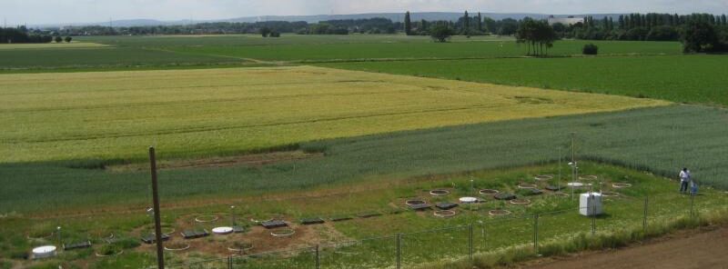
Meeting with neighbor farmers of case study site.

February, 2022
February, 2022

Online webinar - Germany in the context of WATERAGRI.

February, 2022
February, 2022

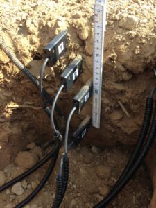
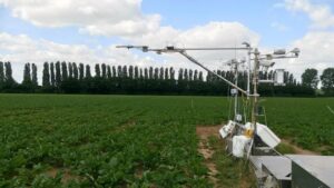
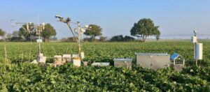
Presentation of a an early-version of the simulation and data assimilation system at WATERAGRI 3rd Workshop.

Back to top of page