Seeland, Switzerland

About

The test site Seeland, Switzerland is the largest vegetable farming region. However, the regions faces major problems. Loss of fertile soil can be up to 2.5 cm annually. Also, there is a significant potential to increase the efficiency of water resources management by optimizing irrigation and by  increasing the efficiency of the daily operation of infrastructure such as drains and channels or pumps. The changing precipitation dynamics make future production targets vulnerable.

WATERAGRI project will maintain the high level of food production in the long-term through intelligent water and soil management. It will optimize the drainage management through real-time management. Our proposed simulation system is based on numerical models running in real time, and is being continuously updated using sensors installed in the field. The system also considers weather forecasts and simulates all relevant components of the water cycle (including ground- and soil water). Our approach has a significant potential to increase the efficiency and coordination of the local water management. Moreover, the efficiency of costly investments such as new drainage systems or irrigation systems will be assessed together with local stakeholders under consideration of climate change.

Run by

Contact

Dr. Philip Brunner

Tested Solutions

At the Seeland case study site three solutions are tested:

Solution Test Progress

The test study site has the largest vegetable farming region. However, the loss of fertile soil can be up to 2.5 cm per year. Therefore, the Agricultural production needs to be maintained in high level.

So far, catchment scale, physically based hydrological model is set up and tested for different scenarios. Additionally, soil and hydrogeological data are measured operationally.

Publications

Physical based modelling outline draft. Project Deliverable

March, 2021
March, 2021

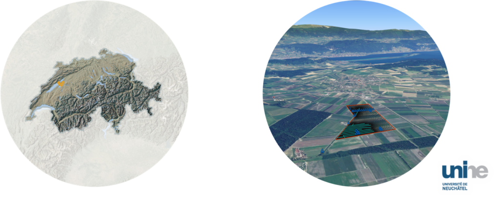
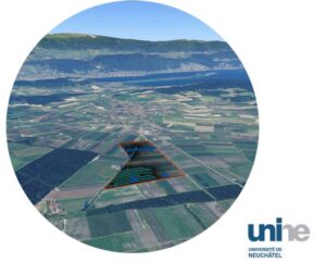
Installation of online sensor network completed.

November, 2021
November, 2021

Hydrological data collection completed and available for storage in GeoDatabase.

June, 2022
June, 2022

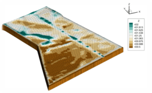
3-D subsurface maps of soil properties generated.

August, 2022
August, 2022

The physically based model using the HydroGeoSphere (HGS) completed.

December, 2022
December, 2022

Preliminary data assimilation routines for HGS tested.

January, 2023
January, 2023

Stakeholder workshop with the largest farming association and local engineering company.

Back to top of page