Remote Sensing Pipeline

About

Vultus is a data-as-a-service (DaaS) provider of analyses and recommendations generated from remote sensing and telemetry data. Our customers and partners use Vultus analyses and recommendations in their own systems, platforms, and/or organizations to provide a unique value to their customers, partners, and users. Analyses provided in this solution are:

  • Normalized Difference Vegetation Index (NDVI),
  • Normalized Difference Water Index (NDWI),
  • Leaf Area Index (LAI), and
  • Surface Soil Moisture (SSM)

Developed by

Contact

Per Karlsson

Ophir Mubarik

Case Study

Where We Test Our Solution

  • NDVI (Normalized Difference Vegetation Index) and NDWI (Normalized Difference Water Index) were already available in the Vultus platform.
  • LAI (Leaf Area Index) validation was done against actual samples from Hungarian (University of Debrecen) and Italian (Canale Emiliano Romagnolo) pilot sites with maize and tomato crops.
  • SSM (Surface Soil Moisture ) validation was done against actual soil samples. 

Solution Test Progress

Remote Sensing Pipeline solution is currently implemented at the Vultus Analysis Platform.

Publications

Remotely sensed data, Project Deliverable

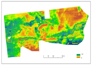
Validation of Leaf Area Index

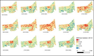
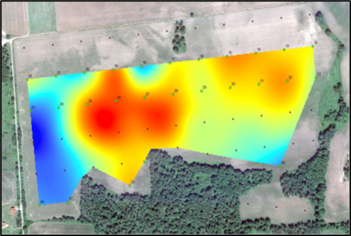
Validation of Surface soil moisture.

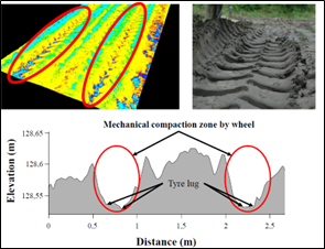
Validation of Crop Phenology Index.
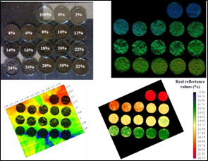
Back to top of page